Utility mapping with RadarMap software
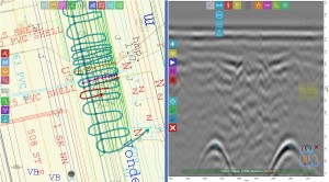
BackRadarMap software is designed for real-time underground utility detection and mapping. Fully touchable easy-to-use user-friendly interface allows to mark all found utilities by different label types, chained between map and georadar profile, with single touch. Software supports multi-layer maps and automatically marking utility position based on the utility layer information.
All detailed information you can find ...

